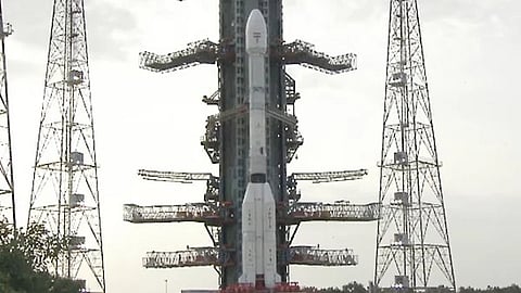

The NISAR (NASA-ISRO Synthetic Aperture Radar) Earth-observing radar satellite has sent its first images of our planet's surface, providing a preview of what to expect as the joint mission between NASA and ISRO (Indian Space Research Organisation) begins full science operations later this year.
“Launched under President Trump in conjunction with India, NISAR’s first images are a testament to what can be achieved when we unite around a shared vision of innovation and discovery,” said acting NASA Administrator Sean Duffy.
He added, “This is only the beginning. NASA will continue to build upon the incredible scientific advancements of the past and present as we pursue our goal to maintain our nation’s space dominance through Gold Standard Science.”
The images from the spacecraft, which ISRO launched on July 30, illustrate the level of detail with which NISAR scans the Earth, providing unique, actionable data to decision-makers in various areas, such as disaster response, infrastructure monitoring, and agricultural management, The New Indian Express reports.
“By understanding how our home planet works, we can produce models and analysis of how other planets in our solar system and beyond work as we prepare to send humanity on an epic journey back to the Moon and onward to Mars,” said NASA Associate Administrator Amit Kshatriya.
The successful capture of these initial NISAR photographs is viewed as an outstanding illustration of how partnership and collaboration between two nations on opposite sides of the earth can yield incredible results for the benefit of mankind.
On August 21, the satellite's L-band synthetic aperture radar equipment, which was provided by NASA's Jet Propulsion Laboratory in Southern California, captured Mount Desert Island on the Maine coast. Dark parts in the photos depict water, green areas suggest forest, and magenta spots show hard or regular surfaces such as bare ground and structures.
