
Some say that machines can never replace the finesse and etiquettes of manual exertion while some are of the opinion that they are the economical and reasonable alternative to occupations that border drudgery. Both of these claims hold a vial of truth — man can succeed where machines falter, and vice versa. Step in Rohan Sinha, a civil engineering graduate from IIT-BHU who works as an evangelist with Indshine. No, not the religious preacher who seeks to sway others to their faith, but rather the go-to person for handling clientele needs of a prominent company.
Indshine specialises in operating various drones that can map entire regions of forests, railways, highways and the like, aside from generating 3D models based on engineering drawings. "All of our offerings are done digitally, and this has caused a shift in the way these industries work. With everything going online, people are aligning themselves with each other, adding immense value to the larger scheme of things," says Rohan.
The idea behind the creation of this cloud platform, according to Rohan, was the company's desire to present accumulated information in a 3D format with visible parameters, "We don't want all this information to be tied up in files. We want it up there for everyone to see." The core team, the unit responsible for the drone operations, consists of software engineers, electrical engineers and civil graduates from IIT-BHU.
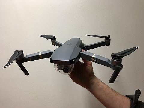
Drone Regulations 1.0 is a framework that regulates the pre-requisites of flying a drone in India. Things like third-party insurance and hull insurance are mandated, even though no such policy is currently redeemable. "DGCA promised to launch Digital Sky on December 1, which it did, but it simply doesn't suffice. It is currently a dummy platform," says Rohan. Talking about the procedure regarding getting these miniature sentries into the sky, he lists out a two-fold protocol, "First, we get the alignment of the region in question. The drones are then set to auto-pilot mode, covering a pre-designated flight route. There is no manual input required — we simply switch batteries as and when required. Post-surveillance, we chalk out high-resolution maps, which are then integrated into the acquired information, along with models." Indshine presently wields an arsenal of 15 drones, although their operational range is limited to 3 km each. With 8000mAh batteries powering them, they can remain airborne for 25 minutes.
Indshine has served a number of clients, including major players like Indian Railways, TATA, L&T, NHAI, Mahindra and MRIDL. The military sector, however, remains slightly beyond the company's current capabilities. "We're in touch with the army and the air-force personnel, but what they require is quite unique. Their requirements entail drones with larger capabilities and longer flight durations — this really pushes the boundaries of what a drone can do," says Rohan.
In Shimla, the firm utilised drones to enumerate deodar cedars, and by monitoring which pickets are falling short of trees, vigilance can easily be heightened in the afflicted region and thus, the probability of catching culprits is increased exponentially. The company's existing portfolio of undertakings includes providing drones to assist in securing VIPs and monitoring VIP movement, primarily in Jaipur.
For a country that is already splurging vast resources on safeguarding politicians while the common man fears for his life on a daily basis, this, at first glance, appears incomprehensible. But Rohan offers an alternate explanation. "A drone can count how many windows and openings are present in the VIP's projected path, and provide the authorities with the best possible deployment plan for allocating armed security. That means you need much fewer men with guns," adds Rohan
Indshine currently operates an in-house platform, labelled as Felix, which aids in the generation of 3D models and drawings. "Our ultimate aim is to develop a geospatially intelligent system that can initiate the digital renaissance for the Indian infrastructure industry," concludes Rohan.
