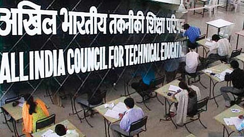

All India Council for Technical Education (AICTE) in association with Indian Institute of Technology Bombay (IITB), Indian Space Research Organisation (ISRO) and FOSSE (Free Open Source Software in Education) is hosting an 'Online Mapathon' event to promote the use of Indian satellite imagery for developing resource maps in the country.
The online event has been inaugurated on 07th Dec 2020 by Dr Anil Sahasrabudhe, Chairman of the All India Council for Technical Education (AICTE), Prof. Subhasis Chaudhuri, Director of IITB and Prof. Kannan Moudgalya, Principal Investigator, FOSSEE IITB. A crowdsourced mapping initiative, IITB-ISRO-AICTE Mapathon aims to popularize the use of Indian satellite imagery and the use of open-source educational tools to create resource maps for the country. Through this Mapathon initiative, AICTE, ISRO and IITB aim to sensitize the public about the potential of ISRO data for various uses that include tracking natural calamities, floods, droughts, crop failure, soil fertility assessments, water and cropping area.
Dr Sahasrabuddhe told Edex, "MAPATHON allows students to learn open source free software QGIS and apply it for creating layers of information about a district city or town on terms of different fields such as hospitals, beds available, diseases, patients, ration shops, cloth shops, hotels and restaurants, grocery shops, pharmacy shops, schools colleges, workshops etc. These information will then be useful for people in the area, including during pandemic or natural calamities or accidents for evacuation. So participation in MAPATHON is a win win for self and society."
"Even though the Indian government agencies are using ISRO maps as a key tool for resource analysis, most of these maps are not made by common citizens, thus lacking in their comprehensive usage," said Professor Subhasis Chaudhuri, Director of IIT-B.
“Crowdsourcing and citizen science activities can aid in rapidly and locally processing satellite images to make maps through the National Mapathon. This Mapathon will use freely available ISRO satellite images, and with help of an open-source QGIS software to provide uniform outputs spatially and temporally for the entire country,” added Chaudhuri.
As the public is invited to improve resource mapping using free content from ISRO, the program is expected to enhance coverage and develop layers of important resources which can help disaster risk assessment, energy management, crop yield estimation, crisis control and other tasks.
Experts in this sector believe that maps developed using public inputs will elevate the accuracy to a great extent, and could play a crucial role in solving and managing complex real-time problems.
Dr Anil Sahasrabudhe, Chairman of the AICTE, said that there is a need for popularizing Indian databases developed by ISRO, especially at this time when India is moving in a direction of being self-reliant. He added that no amount of foreign imagery/resource map can come close to accuracy than what is developed by crowdsourcing by Indians for themselves owing to the intimacy of the area to which they belong. It shall also discourage Indian researchers who are making use of foreign databases and thus make their research more relevant.
"ISRO spends hundreds of crores launching earth resource observation and mapping satellites and even cloud penetrating radar satellite images, which produce high-quality imagery at multiple spatial and temporal resolutions, covering the landscape of India and across all seasons. This Mapathon will allow Indian researchers to use that data obtained by Indian satellites, rather than relying on foreign data," said Dr Sahasrabudhe.
These maps are also expected to have crucial applications in climate change adaptation, education, logistics, natural resources management, disaster management, health, geography, forest management, socio-economic factors and local administration. Moreover, the proliferation of satellite images and crowdsourced data has made a multitude of GIS maps that could be easily accessible via smartphones to all. “Such unison of remote sensing GIS data and observed data are needed to understand and solve real-time problems”, added Dr Sahasrabudhe.
This event is coordinated by the FOSSEE project, funded by the Ministry of Education, Govt. Of India. The FOSSEE project was started to promote the use of open-source software. The Principal Investigator of this project, Prof. KannanMoudgalya, said, “The map creation for the Mapathon has to be done using open-source software, such as QGIS. Use of open-source software provides a level playing field for all participants, as the software can be used free of cost”.
“One can self-learn the open-source software QGIS using Spoken Tutorials, in English, and dubbed in Hindi, Kannada, Malayalam, Tamil and Telugu, available at https:/spoken-tutorial.org”, added Prof. Kannan.
“The developed maps will be hosted on open source archives (such as FOSSEE and RuDRA at IITB) so that anyone can access them for community applications. This Mapathon can aid in building local capacities for mapping and generating data that can address larger goals,” said Prof. Pennan Chinnasamy of IITB, who specializes in GIS applications.
The event is expected to draw participation from a variety of backgrounds, including students and rural youth, as well as government employees and professionals in the fields of GIS. Those interested can register on https://iitb-isro-aicte-mapathon.fossee.in between Dec 7 and 18. Completed maps have to be submitted between Dec 14 and Dec 31. The results will be announced from January 4 to 10. Creators of completed entries will receive certificates jointly issued by AICTE, IIT Bombay, ISRO& FOSSEE.
